
Translated material
Google geolocation services go beyond cities - now you can see penguins there
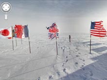
Users of the Google Maps cartographic service (in the Russian version of the Google card) got the opportunity to see panoramic pictures taken at the south pole of the planet. The project was implemented jointly with the University of Minnesota (USA), reports CyberSecuritylab .
According to Google representatives, polar pictures are part of the program for the development of the project to create panoramic pictures of Street View, related to the "exit beyond cities." Previously, Google has already posted pictures of the forests of the Amazon, the ancient Stoneje in England, as well as a number of historical objects in South America.
New data allow all Internet users to virtually visit Antarctica without leaving their home. In panoramic photos there are all the traditional attributes of the South Pole: penguins, shelf glaciers and endless snow spaces.
Antarctic Street View also allows you to get some additional data regarding the southern point of the planet. New panoramic photographs were provided by Google both the University of Minnesota and a number of scientific institutions of other countries of New Zealand and South America.
Note that the polar panoramas are somewhat different from a technical point of view from traditional panoramic photos on the Street View service. Polar images were taken on special cameras placed on static stands and “fish eyes” equipped with lines for the maximum viewing angle.