
Translated material
House of cards
Konstantin Benyumov - about how the fate of Soviet military maps in Latvia developed
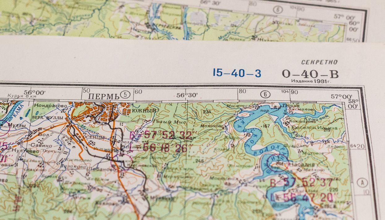
In mid-July 2015, Wired magazine published an outline of Greg Miller about Soviet topographic maps. These cards have been compiled for decades, in the smallest details (for some cities - up to individual houses) the whole world has been applied. Wired calls them "one of the most ambitious cartographic projects in history." Of course, the cards were developed for the needs of the military, printed by the General Staff and stored in military units and institutions under the heading “secret”. But even before the actual collapse of the USSR, the secret maps of the General Staff began to penetrate west; Moreover, they bought them from the Soviet military not at all for souvenirs - the papers turned out to be perhaps the most accurate cartographic instrument of the pre -intake era. The main source of Soviet maps for Europe and the States, apparently, were the former Baltic republics: in the story of Miller, in particular, a half -abandoned military unit in Estonia and a map of maps in Riga are mentioned. This store, which opened in 1993, still exists in the same place. Medusa journalist Konstantin Benyumov met with one of its founders.
On the table in front of the sergeant of the Soviet Army Avars Beldavs, sheets of paper, pencils and poster feathers are laid out. In the yard 1987. Beldavsu 20, he serves in intelligence. Its battalion is stationed to the GDR, 30 kilometers from the border with West Germany - at that time almost on the front line. Beldavs leans toward the sheet, takes a pencil and concentrates in large letters: "Our goal is communism."
“In the army, I actually engaged in design more,” Beldavs explains to me in 2015. - At first I was at the company clerk, then I was taken by the political officer to draw posters. Well, that is, it was possible to rode there, not to run with everyone there. ”
Beldavs first learned about the maps of the General Staff even before the army, while studying at the Faculty of Geographical University of Latvia. Educational institutions, despite secrecy, used approximately the same cards in the work as the military. Of course, they were not given to their hands, but if necessary, it was possible to get acquainted with them. After the army and the University of Beldavs, he worked for some time in a cartographic factory, also departmental, and in 1993 classmates called him to their newly established, still not even opened store Jāņa Sēta.
The basis of the assortment of the future store was Soviet topographic maps.
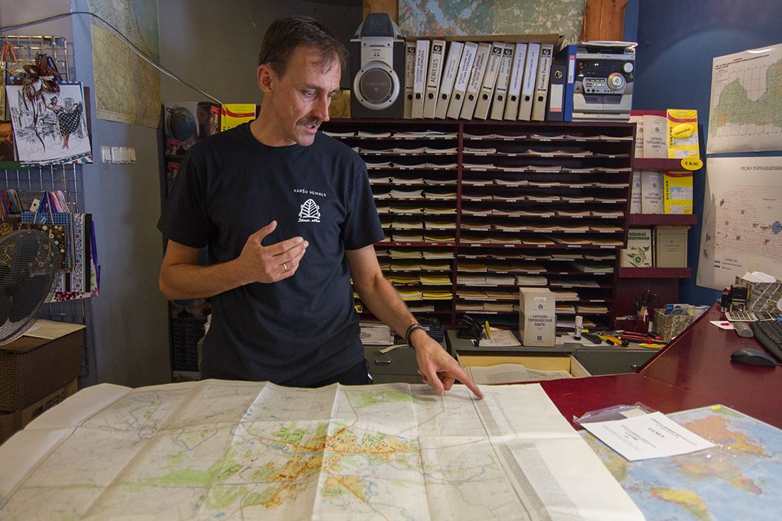
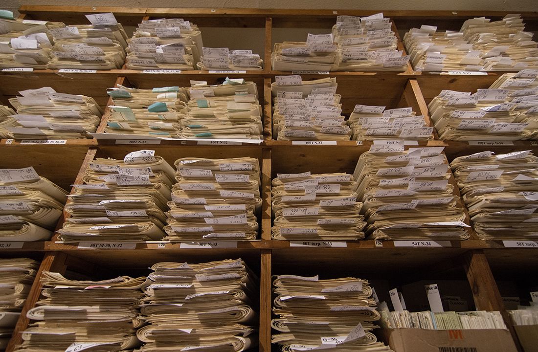
“We usually say that there was a pale with cards for 13 railway cars,” says Beldavs. - I myself did not participate in transportation. But when I saw this, it was a lot! Here [at that time] there was one room, and everything was littered with these cards. Then the store still had a printing house in Cesis ( a small city 90 kilometers from Riga - approx. Medusa ), the main one was taken there and sorted there. There were several dozen tons of these cards. ”
- That is, even before the opening of the store, they specially bought these cards, realizing that they can be sold?
- Specially or not - rather, we were simply offered to us. The military came, [offered to buy] along with canned goods, along with something else. They had to leave.
- In theory, the cards probably had to either be destroyed, or take it out with you?
- With a part of the cards, they probably did so - they were taken to a paper factory for processing. We were invited there to show what they have. And then they brought us not only what we noted what we needed, but almost everything that they had. They were happy to get rid of everything.
I am interested in whether the Russian military tried to put an end to the distribution of documents that may still be considered secret in Russia. Avars tells how at the European cartographic conference in the early 1990s he met officers who came from Russia.
- They saw these cards, come and say: where did you [got them]? - Well, you bought it. - How are we? These eyes made such eyes. I don’t know, then probably someone was unlucky there, they found some extreme and ...
“But they didn’t try to knock on you and take it back?”
- Well, we officially bought them. Here, what, no one will knock here, here is an independent country ... at the moment. Although my colleague says: here they will come here - you are the first ...
Avars laughs, but, apparently, in Russia, General Staff cards and their contents are still seriously treated. Just three years ago, the Moscow City Court sentenced 12 years in prison for espionage of the former employee of the military-technical department of the General Staff, retired colonel Vladimir Lazar. During the process (of course, closed), it was found that Lazarus transferred the topographic maps of the territory of the Russian Federation to American intelligence, constituting a state secret.
The American agent, to whom Lazarus handed over the cards - Alexander Leshment, now living in Estonia. According to the investigation, the lesion, also a Soviet officer, lieutenant colonel, after dismissal to the reserve, moved to Estonia to collect and transfer topographic materials to American intelligence services.
So Beldavs tells me about his business colleague from Tallinn-the former Soviet colonel, who, in the turmoil of the beginning of the 1990s, managed to take some cards to Estonia and began to sell them. “But he already does not speak with journalists, because he is already in Russia, Non Grata,” Beldavs explains.
During the process over Vladimir Lazar, representatives of the FSB stated that the transfer of topographic maps to military departments of other countries threatens the external security of Russia. In particular, topographic maps can be used to compose flight tasks for missiles of all types of basing, as well as for the preparation and conduct of land operations. It is likely that even cards drawn up in the late 1980s contain the data sensitive to the Russian Federation.
* * *
The “13 wagons” who sold the enterprising Soviet military partners - only the microscopic part of the common array of printed topographic cards. In the Latvian SSR alone, they were distributed by millions of print runs, not to mention the entire Soviet Union. However, the scale of the cartographic heritage of the USSR is not manifested in astronomical circulations.
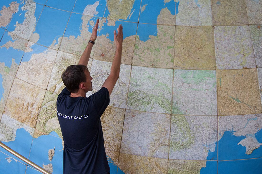
Soviet cartographers methodically applied the whole world on paper, and sometimes several times on different scale - from the largest, 1: 1000,000 (one centimeter on the map corresponds to 10 kilometers on the ground), to a much more detailed 1: 200,000 (in one centimeter two kilometers). The Beldavsa store has a globe composed of relief topographic maps of a scale of 1: 1000,000. More precisely, this is a fragment of the globe - a map of Europe, composed of 74 pieces. The fragment takes a piece of wall with an area of several square meters.
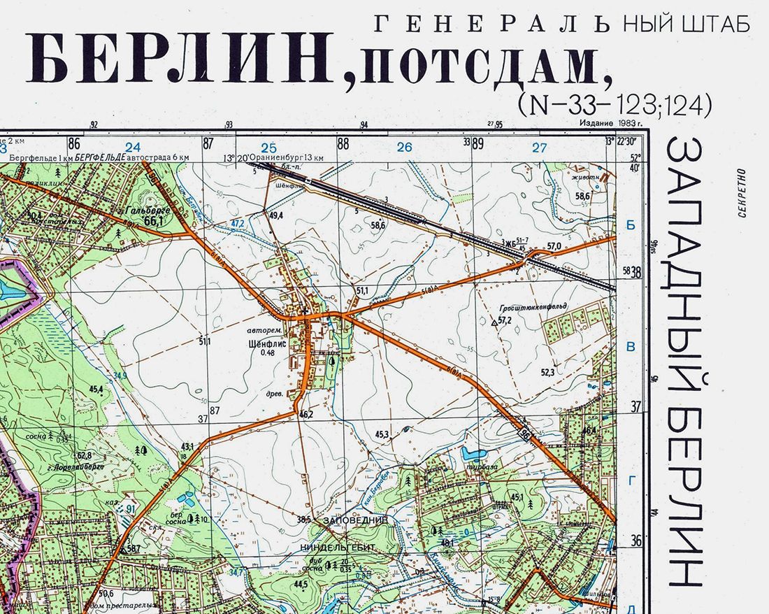
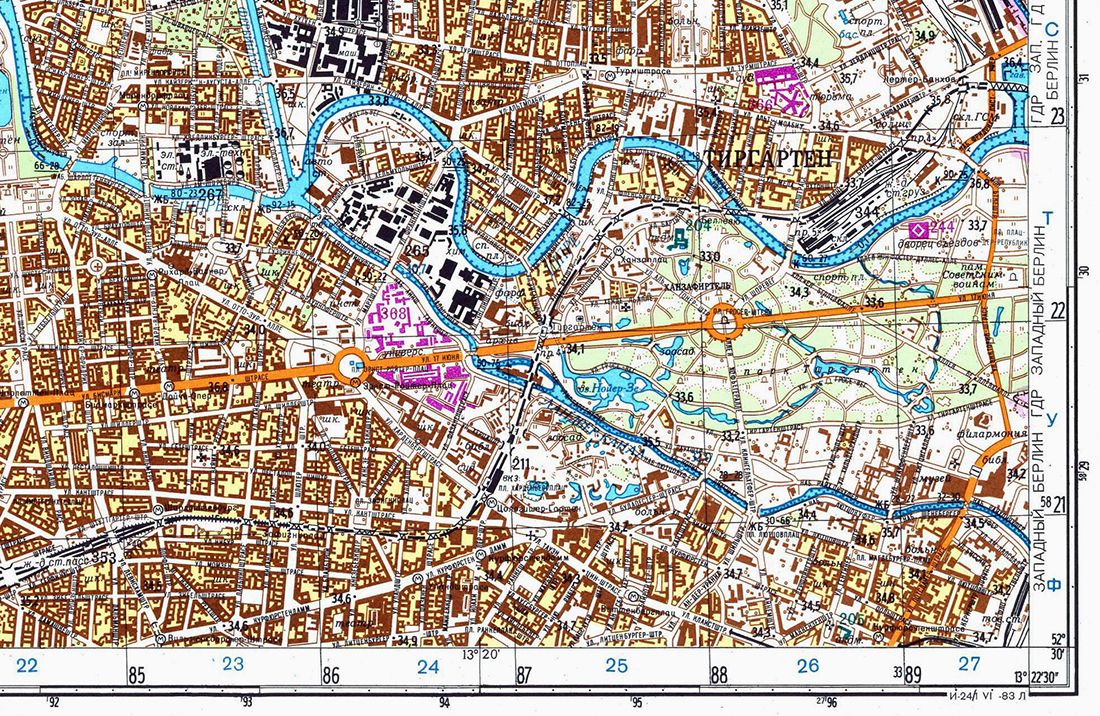
For individual parts of the world, countries and regions in the USSR, there were maps of 1: 100,000 to 1: 25000 - with streets and houses. Finally, there were plans for the largest cities in the world on a scale of 1: 10,000 (in one centimeter of 100 meters): on such plans, all streets and buildings are applied up to public transport stops. According to David Watt, a former librarian to the British Ministry of Defense, who devoted more than a million cards in the USSR to study Soviet military maps for several years, each of which, depending on the scale, could be printed on several dozen sheets.
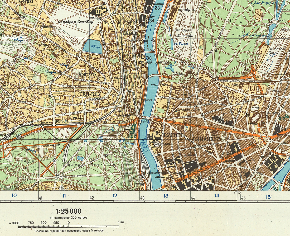
The cards were supplied with detailed signs of strategic objects and streets, and on an average scale - also a detailed description of the area. The descriptions were attached to the most detailed cards in the form of separate brochures.
Of course, the maps were distributed among Soviet institutions in accordance with the tasks and hierarchy. According to Beldavs, in Latvia on a small scale there were mainly maps of adjacent regions: “The closer here, the smaller the scale. Well, the farther, for example, world cards are five hundred and a million. The five hundredth here is cut by the Urals - then there is no, only a million. Europe-two hundred, a hundred, some places-Pentecks, Latvia-Pentecks, twenty-five, there were a dozen, but these were not thrown away, because there were not so many of them, we then got them in the other ways. ”
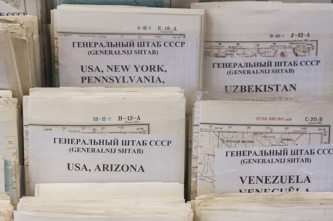
Foreigners say: these plans indicate almost the number of bus routes. Such cards are not made to prepare a military invasion, they are needed to navigate the terrain when the invasion has already been completed. I ask Aivars, for which, in his opinion, such detailed cards were drawn up. “As far as I know, there was not the whole world there. For example, Australia and New Zealand - there was no more details than 1: 500000. Africa, too, with the exception of some countries, like Angola, where there was two hundred. That is, the smaller the scale, the more likely it is that there was some kind of [special] interest. In theory, the two hundreds were for flights, a hundred and fifty - this is already for the army. America was all two hundred, some regions were a hundred, for example, near Washington, which was funny - were they really going to send an army there? Separate slag [history] was with plans for cities. For all the largest cities in the world there were very detailed maps (1: 10000). There were all secret objects indicated. I don’t know why this was done, ”says Avars Beldavs.
For a person who was born in the USSR and lived part of his life in the post -Soviet space, in history with the maps of the General Staff is much less intrigue than for a foreigner. Soviet military maps have long been scanned, many can easily be found on the Internet, or, for example, buy on DVD. But it is surprising that after a quarter of a century, they turned into artifacts of ancient civilization: almost nothing is known about creating a map system, and even people who have been engaged in these cards for decades can only guess about what they were intended for.
* * *
Over the past 20 years, a little has changed in the Jāņa sēta store. The office premises in which we are talking with Ayvars are similar to offices that appeared in large numbers in Moscow of the 1990s. Simple furniture, yellowed white wallpapers for painting - 20 years ago, this was the case of modern office repairs. By the end of the year, the building will close for reconstruction, but I'm even glad that I found the store in the current form.
In the trading floor, the Soviet cards have a large stand. Almost everything is in excellent condition, they are laid out according to plastic folders and sorted into countries-only black and white labels printed on a regular printer are visible. It is not immediately possible to discern this stand between the shelves with atlases, globes, reprints of old cards and glossy guides. Most of all, this resembles a musical store in the beginning of the zero, when the official revival of the vinyl has not yet begun, and the records were modestly stood in boxes somewhere in the depths of a hopelessly outdated format.
The Soviet military maps have already experienced their revival - just thanks to the enterprising military, successful people like Beldavs and its clients, including from the USA and Western Europe.
“When there was no store yet, we have already sold these cards,” Beldavs recalls. “They bought the first computer on them, which, as I remember now, cost 15 thousand dollars, and people worked on it in four shifts.”
First, the cards were bought mainly by the inhabitants of Latvia: “We have never seen such cards. The last time we saw [similar cards] in 1940, then everything became secret, or there were some cards that were more like schemes than cards. Distorted, without scale. For example, Riga’s plans - not all streets were drawn there. ”
The cards were purchased, according to Beldavs, not only private individuals, but also organizations: “We have everything, and the police and firefighters, we bought it. Until our normal ones have been made, and this has passed five to six years, while they took a picture while examined, ours was bought. We sold to libraries, to Western stores. ”
In the West, telecommunication companies were the main buyers. For example, on Soviet military maps, mobile ties were built in Asia and Africa - more detailed topographic maps of these parts of the world simply did not exist. In the early 2000s, American intelligence services used Soviet maps of Afghanistan.
Soviet topographic cards have no collectible value - in any case, for now. In the Beldavsa store, the original card sheet costs from three to ten euros. The original pre -war cards, of course, will cost much more.
In recent years, cards have been sold worse, but, according to Beldavs, there is no “collapse”, and even satellite navigation will not supplant the paper topography finally: “Those who use navigation have already understood that one navigation should not be used, we need some backup on paper too.” Worse is that new paper cards may no longer appear. “I can be mistaken, but [in all of Russia] normal cartographic firms that do something else, it seems to me five or six,” Avars complains.
But the Beldavsa store is the largest in Eastern Europe, and all the utility rooms in it are still littered with rolons of cards.
- For a long time, this heap is still enough for you?
- Don't know. It’s probably enough for my life.
Konstantin Benyumov
Riga