
Translated material
Project "Mud"
We divided the center of Chelyabinsk into blocks. Each sector is assigned to an activist who walks through it, photographs problem areas and marks them on the map of the quarter.
Algorithm of actions
Select any of the red sectors on the city map . Yellow blocks - already occupied, green - completed.
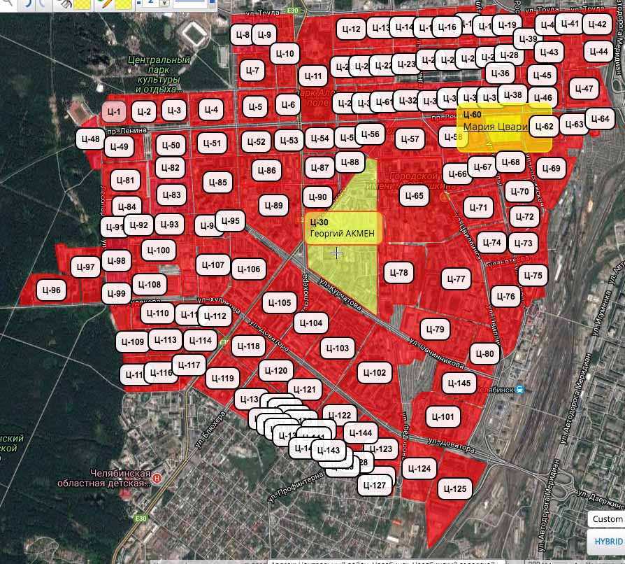 Screenshot of a map with sectors
Write to Sergei Kochetkov in private messages the number of the selected quarter and your last name and first name. He will assign the sector to you, now it is yours.
Take a walk along the outside façade of the block. To begin with, we inspect only the front part of the sector, without going into the courtyards.
You only need to go around your part of the street:

Take photographs of the problems indicated in the list below. Mark them on the screenshot of the block with lines of different colors - this way we will understand the extent of the problem area.
Each color is already assigned to a problem type:
- blue - open ground and paths;
- green - ground level on the same line with the curb or above it;
- red - cracks in curbs;
- pink - partially destroyed curb;
- blue - remnants of winter reagents, dust and crushed stone;
- orange - puddles and depressions.
Upload the pictures to your computer, rename them by numbers from 1.jpg onwards. Mark the photo numbers in the circle on the screenshot with the map:
 Open ground is marked with a blue line and photographed, the photo is called “14.jpg” and is in the archive
The end result should look something like this:

Send a screenshot of your block with designations and a .zip archive with photos to chelurbandirt@gmail.com. The subject of the letter is the quarter number:

Write to Sergei Kochetkov on VK: “Sector Ts-42 has been commissioned. Photos and screenshot of the card in the mail."
He marks it in green.

Ready! You are a hero.
Then we will systematize all the areas, make layers by type of problem, and over the winter we will prepare a big proposal for the city administration for a large-scale fight against dirt. This is where the “Urban Environment” project with its large budgets comes into play.
What to celebrate
Open ground, that is, just earth, and well-trodden paths (indicated on the map with a blue line).

The ground level is in line with the curb or above it, even if it is planted with grass (indicated on the map with a green line).
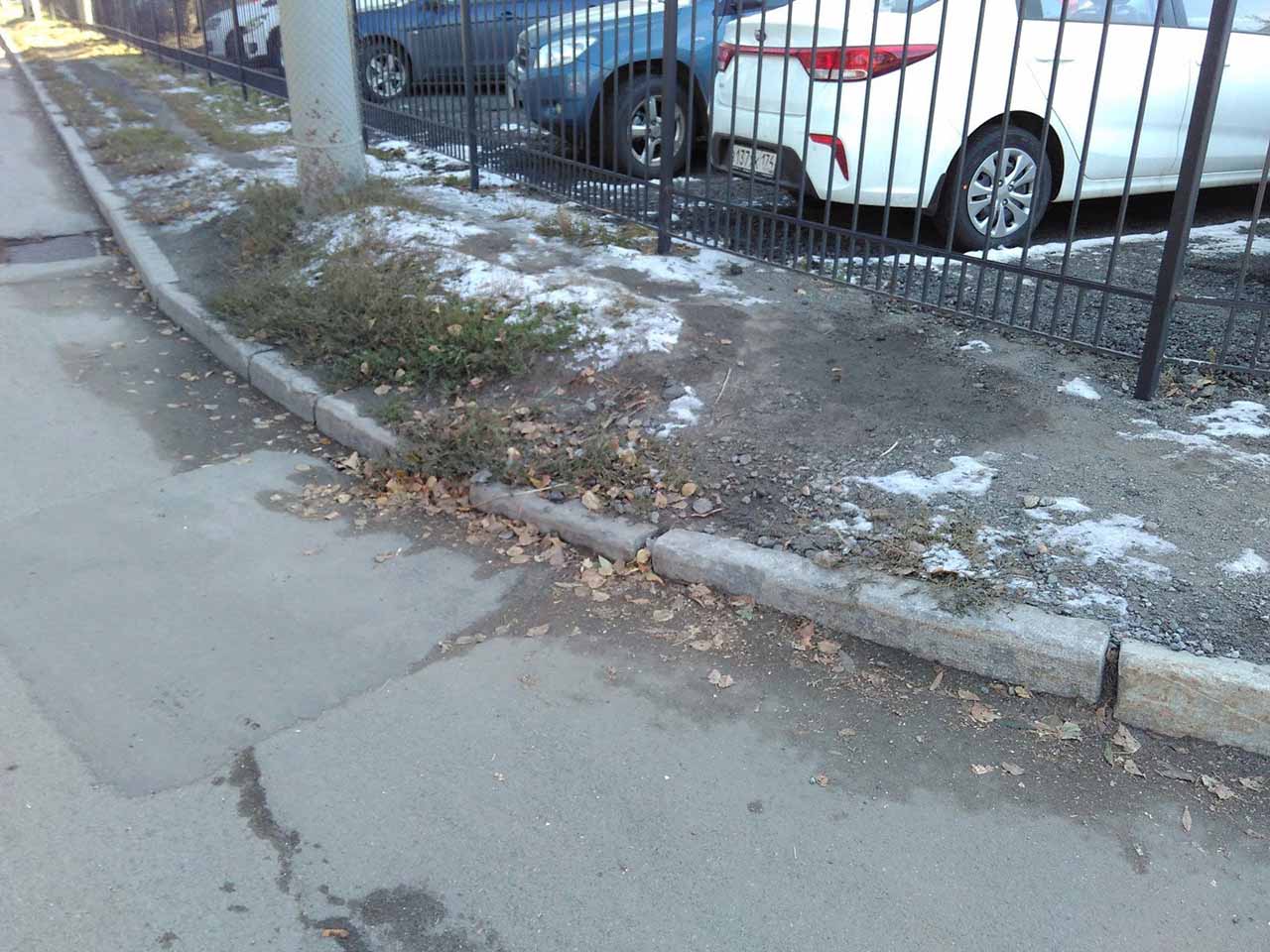 The ground level must be at least 10 cm below the curb or path
Non-waterproofed border joints or their complete absence (indicate on the map with a red line)
 The gap needs to be filled with concrete
 In the photo above, the k-k-combo is a gap in the curb and high ground. :-)
To be honest, almost all the seams in the city are not waterproofed, this matter needs to be corrected.
Partially destroyed curb, road or sidewalk covering. This includes all the potholes, broken roads and anything concrete that is crumbling (indicate on the map with a pink line)
 The curb is gone
  The concrete is crumbling
Remains of winter reagents, dust and crushed stone (indicate on the map with a blue line)
 The reagents look like sand, http://civilpatrol.info
  Dust
DustDepressions on roads and sidewalks in which water accumulates or, in common parlance, “puddles.” When they dry, a layer of dust remains (indicated in orange on the map)
 Future puddle
  Parking in a low area, dirt accumulates here too
Contacts
Group of the project “Dirt” VK: http://vk.com/chelurbandirt
Group "Chelyabinsk Urbanist": http://vk.com/chelurban
If something doesn’t work out for you or you have questions, write to the project group or Sergei Kochetkov .