
Translated material
Cards in hand
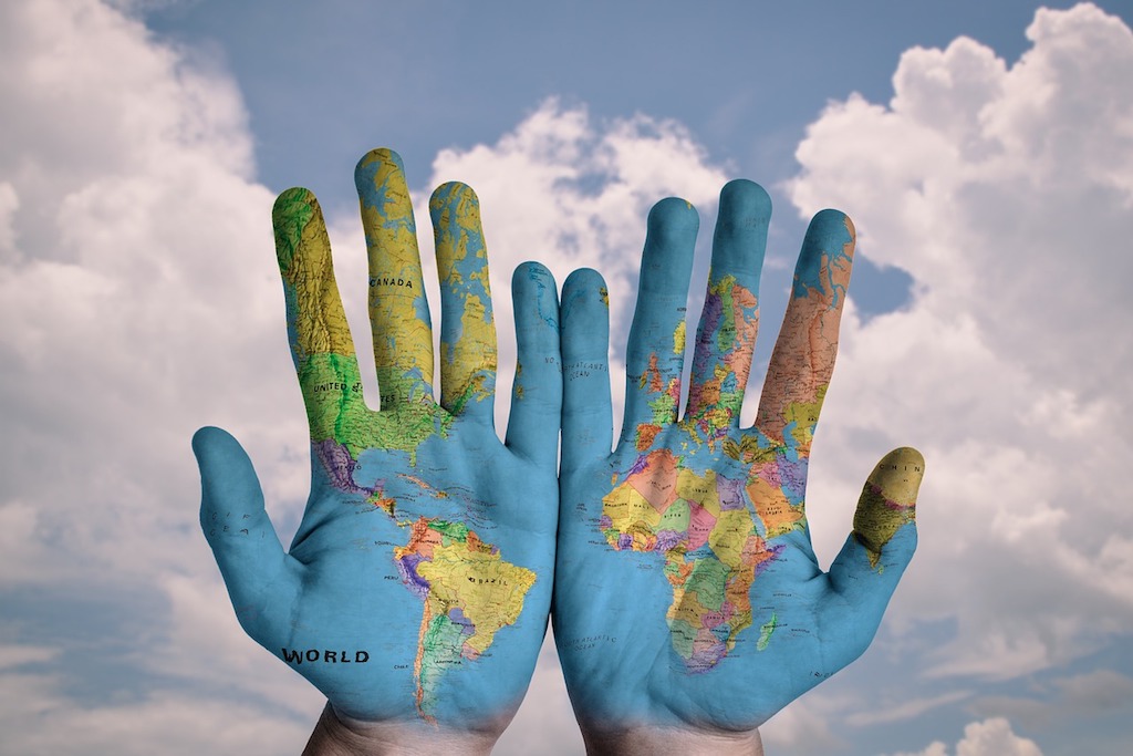
Maps have always accompanied humanity, helping him to determine his place in the world. Over their history, they have come a long way from cave painting, symbolism of “speculative geography” and cosmology to modern three -dimensional maps of the seabed.
Once upon a time, the creation of one geographical area could take years. To understand its features, the territory had to go around or go around. Therefore, the greater the geographical space displayed the ancient map, the more space on it was diverted under fantasies and myths.
In the constantly expanding world of the era of the great geographical discoveries of the phantasmagoria, they were gradually supplanted away. They were replaced by cartographic projections. Here, cartographers encountered a new challenge, the relevance of which remains to this day - by transferring the globe into the plane of a two -dimensional card.
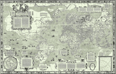
One of the most famous of them is an equangible cylindrical projection ( the projection of the Mercator, was created by Gerard Mercator in the 16th century and survived to date.
Mercator called his collection of cards “Atlas” in honor of the ancient Greek titanium Atlas, who kept the sky on his shoulders. In his projection, parallels and meridians are represented as straight lines, which during the mercator greatly facilitated marine navigation, but even then and now it is pretty distorting the proportions of geographical objects, especially continents.
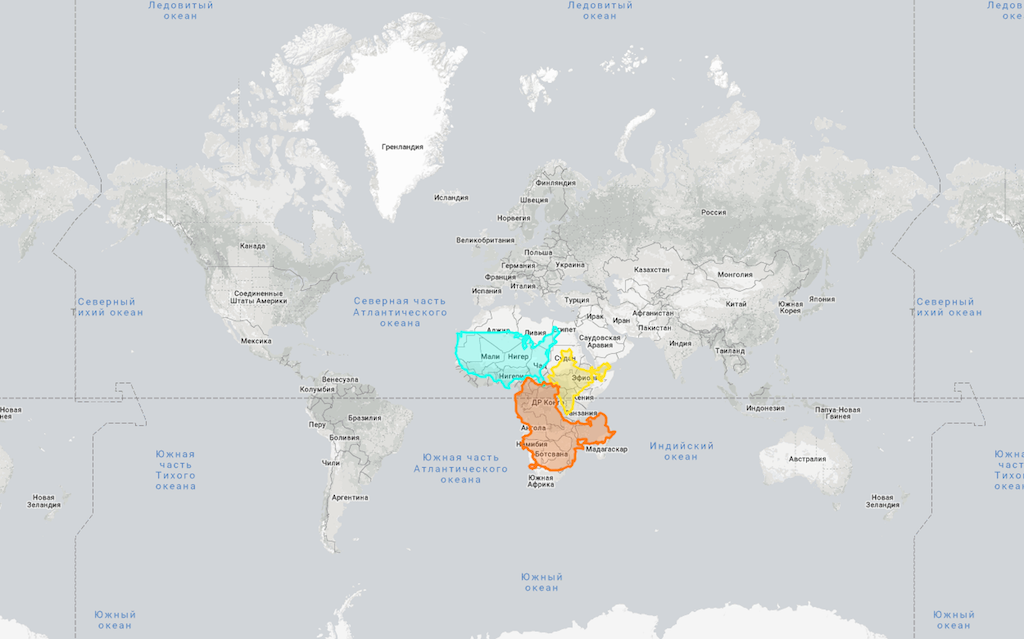
Here you can see their real sizes and compare with their “edited” versions in the projection.
The problem of distortion during conversion from sphere to the plane has not been solved so far. But the cartography was strong, turned into scientific discipline and, like many other spheres, survived the second birth of in a hundred years with the development of technology.
First, she had access to air from the air - aerial photography, which decisively changed the accuracy of the cards of even the most inaccessible areas. Then, remote sensing methods, geoinformation systems (GIS), GPS, and since recently, the big data of unmanned flying devices (UAVs), were received into service of cartographers.
Old functions, new opportunities
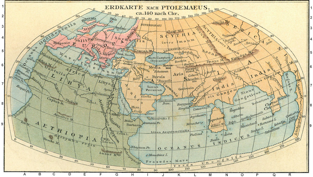
Modern cards are still quite recognizable. Most of them are all the same two -dimensional images as Ptolemy cards . They perform the same functions initially assigned to them: to help navigation and store information about the world. As before, cards are one of the most important tools for the analysis of spatial connections between objects.
Otherwise, the cards have changed dramatically. They have become more affordable than ever. With an abundance of services and digital tools, anyone can easily personalize and distribute their card with ease.
The cards have ceased to be dumb, static schemes. Of the pictures in time, they turned into dynamic canvases capable of storing and transmitting information about the most diverse characteristics of the spatio-temporal continuum within a separate territory. At the same time, one card can replace many paragraphs of the text and tie many scattered parameters together.
These new qualities turned cards into favorite tools for narration and visualization. They thoroughly relies on any sector of activity where it is necessary to present information, including multimedia journalism and the civil sector.
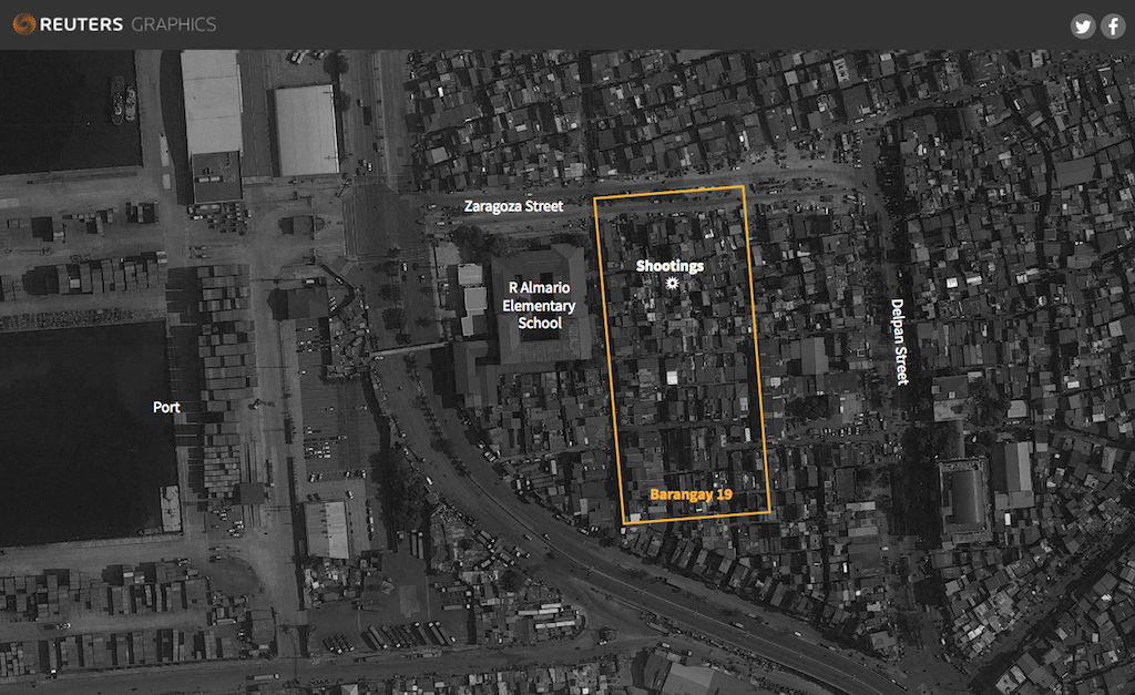
An interactive card often accompanies the journalism of investigations, as in this material Reuters about operations as part of the “war” of the Philippines regime with drug cartels.
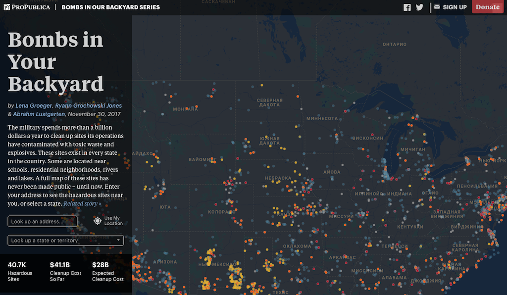
On this map of the United States of the Propublica project, the name “Bomb in your yard” applied places where, after the tests and operations of the American military, toxic waste and explosives were preserved.
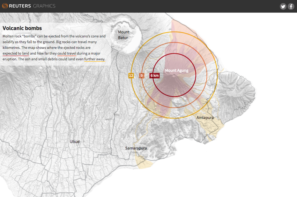
Or this Agung card is a “waking up” volcano on Bali.
In 2018, the global network of journalists of investigators " Mapped the Members ." The group prepared a study of the OpenStreetMap open source code - the so -called Wikipedia in cartography, and came to the conclusion that in this project, as in cartography as a whole, the gender balance was not sufficiently observed, which affects the content of cards.
According to the authors of the study, it depends on the cartographer which objects will be marked on the maps: bars, sports clubs or organizations of assistance to the victims of domestic violence and clinic, where you can use emergency abortive means. And the latter, as indicated in the report, on the OSM cards is much less than the first.
Due to their indication and clarity, the map became indispensable in the analysis of phenomena that have a certain geographical binding. By layering facts and data on the surface of the map, researchers often manage to detect hidden patterns and patterns.
So, the application of additional information on maps back in the 19th century made it possible to significantly promote scientific areas as, for example, epidemiology.
Much later, in 2016, German researchers used the same OpenStreetMap to analyze the regions of the planet, where the roads still did not stretch, which makes these areas the least affected person. They also found that only 9 percent of these lands are currently extended by environmental protection initiatives.
Some organizations consider the preparation of cards or filling out “white spots” on them with their main mission. For example, Hot or Missing Maps , whose tasks include replenishing the maps of regions subject to natural and other disasters, but located in "dead zones". This is done in order to facilitate the humanitarian response in the case of cataclysms.
Maps and right to personal life
From neutral objects, the maps turned into very personal attributes. Modern cards rotate around users. Their ability to continuously broadcast the position of the object in space made each user literally the center of the world.
The map is repelled from its position in space, takes into account its tastes, knows its habits and adapts to interests like Google Maps, CityMappper, Maps.me and dozens of other applications and services created to always be at hand.
Because of them, because of them, in the modern world, the issues of using cards unexpectedly closely intertwined with the problem of ensuring the right to personal life, when one use of digital cards, helpfully offered by Google and others, may mean loss of control over how information about our private life is distributed.
The geolocation function, which significantly facilitates navigation, has its opposite side. Data on the location of users is an extremely valuable volume of large data. With their help, it becomes possible to get a fairly complete idea of a person’s life.
High-tech players either collect this information themselves for internal use, or transmit to the third parties. According to Fast Company , in fact, any application based on determining the location of the user is engaged in collecting such information.
The “card” giant Google is especially active in this area. According to the investigation of the journal Quartz , Google, published last year, could determine the location of the user even with the disconnected function of geolocation and the extracted SIM card, collecting information about the exchange of data between the smartphone and mobile towers.
According to the results of the study as part of the Exodus project , the purpose of which is to analyze various mobile applications for their invasion of private life, three of the four Android applications contain “bugs” that follow the user movements and store this information.
Alternative non -cardography
The maps went far beyond the limits of geography, and some have nothing to do with it at all. Mapping (mapping) is a megapopular term that has the widest meaning: from directly cartography to the mapping of the brain, genes and ideas.
So, cards have always been the subject of decor and art. The new century has discovered new opportunities for creativity. American artist Bill Guffy draws scenes “spied” by him on the streets of the world in the Google Street View.
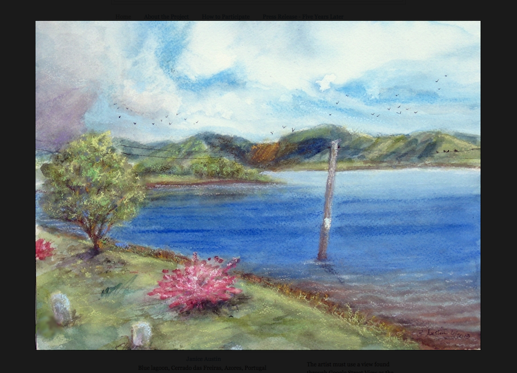
Those who wish can join his virtual evenings of drawing and send their work. The main condition of the competition - the inspiration for the picture should be a real fragment from Street View.
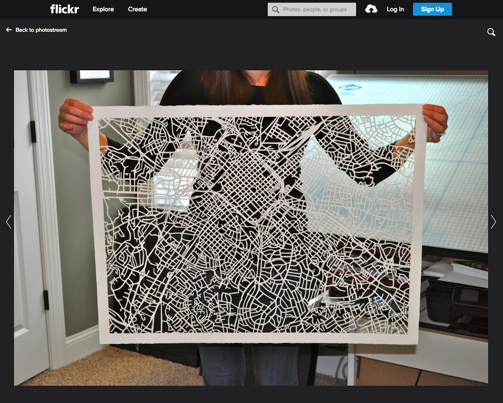
The artist Karen O'LIRI on cities maps discards everything except the transport routes, and turns the intricacies of city roads into objects of art.
Interesting experiments are conducted by Good City Life, which works with big data. In her projects, the cards are designed to convey emotions - to demonstrate how people perceive the space in which they live. The Good City Life has “smacking cards” or “talkative maps” of cities such as Barcelona, London and New York.
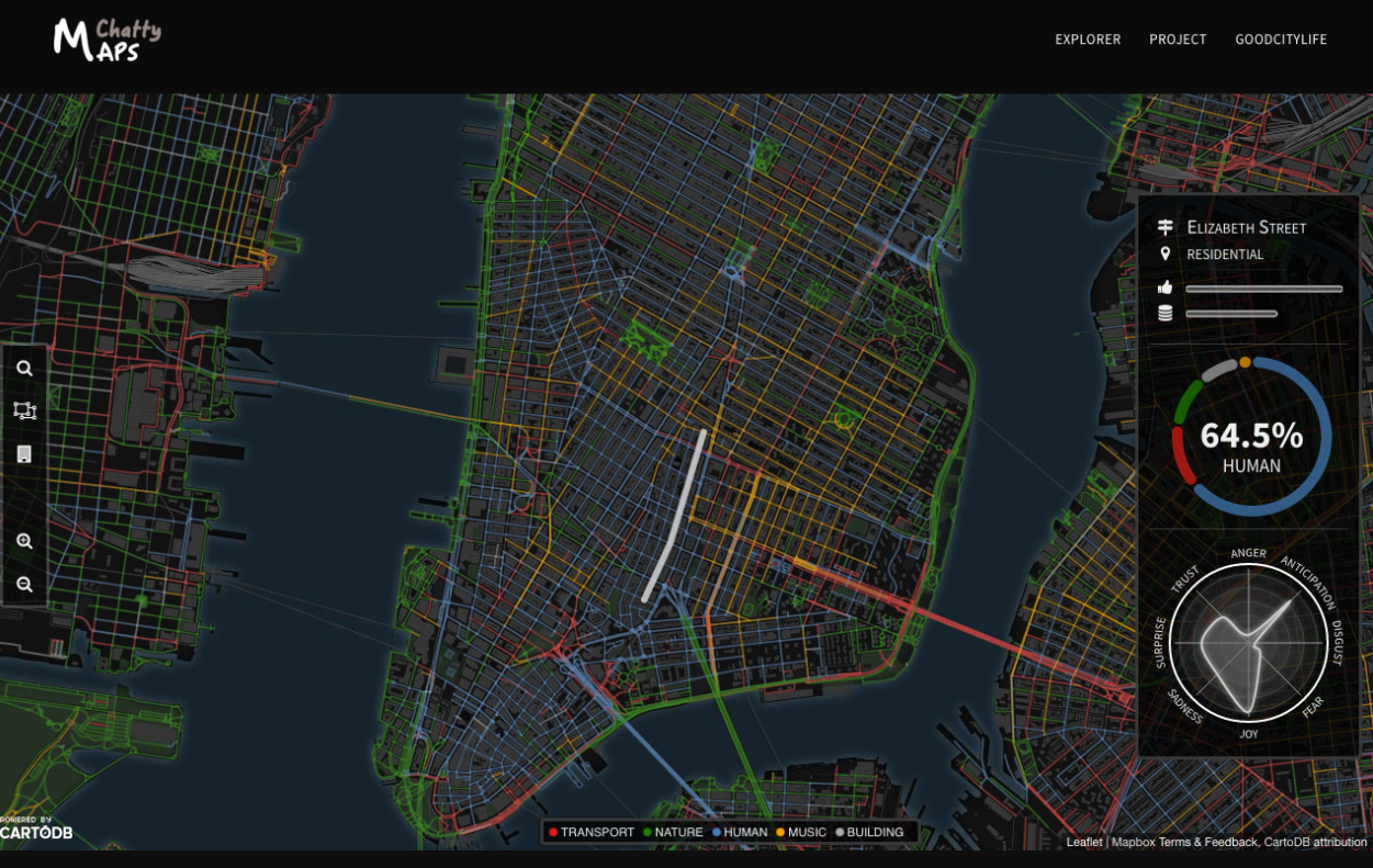
With the help of these interactive images, you can find out what it smells or how this or that street of megacities sounds.