Date
Author
Ирина Андрианова

Preserved copy
Translated material
Unfulfilled trace
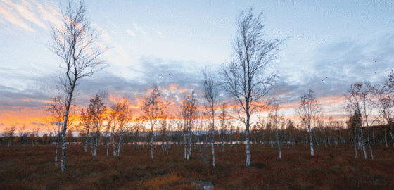
In a secrecy environment, designers draw a highway CAD-2 through protected forests and protected reserves.
Natalya Reiner, an eco-active from the village of Toksovo, Leningrad Region, met people in the forest north of the Kavgolovsky lakes who launched a quadrocopter into the sky and celebrated something on the map. It turned out to be employees of the Avtodor State House, who studied the trace of the new ring road around St. Petersburg-KAD-2. She asked for permission to photograph their scheme, but, having received a refusal, she sketched from memory what she saw: a track that could go straight through the recently created specially protected natural territory (protected) “Toksovsky Natural Park”, 500 meters from the coast of the Kavgolovsky and Kurgolovsky lakes. Further, the road goes east along the forest coast of Lake Khppoyarvi and cuts in two forests of the Rzhevsky landfill - the last Big Laws of St. Petersburg.
It would seem, why was it stealthily spying on someone’s shoulder, if you can simply study official trace? But the fact of the matter is that she is not. Tiny maps published in the fall by the Government of the Leningrad Region do not give any idea about which forests and banks of which lakes will go CAD-2. The topography on them is so blurred that it excludes all specifics: after all, it is worthwhile to appear specifics, questions will immediately sprinkle. For example, those that already bother the Tox asset, namely -
U, barely having time to create the Toksovsky natural park, the authorities are in a hurry to destroy part of its giant road construction?
Activation of work on KAD-2 began after a reminder of Vladimir Putin, who was made by him last summer at a meeting with the governor of St. Petersburg Alexander Beglov. After that, the profile departments fussed so much that they abandoned the previously alleged project of tracing, which was on the existing “concrete” A-120. About him, the governor of the Leningrad Region, Alexander Drozdenko, in September spoke as the most preferable, as he minimizes the need to redeem land. The option was also good because it assumed a minimum of forest logging. However, the performers suddenly abandoned him and chose another - with a laying of a completely new track. The redemption of land here will also be small, because the road will go through the state forest. But you will have to cut down several thousand hectares of the most valuable in recreational terms of the array. And most importantly, it will be sawn in two protected areas, the creation of which the active inhabitants of Toksovo gave several years of life. It turns out that they saved the forest from private developers to give it to state milk?
At the same time, the relevant departments answer all questions that there is no project yet, but there is only a “study of tracing options”. But when it comes to the stage of the project, no one will listen to the public more and more. Several formal public hearings will be organized in settlements through which the road will go, where one and a half dozen pensioners come to “take into account their comments” and will transfer documents for further approvals. Comments that the heads of road departments give are extremely stingy. Nobody says about cutting forests and destruction of protected areas, as if it should not be attention. Avtodor GKU, which does not even have a representative office in St. Petersburg, promised to transfer its materials directly to the Ministry of Transport.
That is, the fate of the Leningrad forests will be decided in Moscow.
At a press conference in TASS, which was held at the end of last year, the Deputy Chairman of the Government of the Leningrad Region for Transport and the Fuel and Energy Complex Sergey Kharlashkin confirmed that the work on tracing the route is actively: “The main task is to build the most convenient road near the existing ring, the conversation about the use of old concrete. The new road will be much closer to the room. They plan to lay the track in such a way as to minimally affect the interests of the inhabitants of the Leningrad region and summer residents of St. Petersburg. The route, which practically eliminates the demolition of residential buildings and production sites, is tracing, which partially hurts military testing grounds, negotiations with the Ministry of Defense are already underway. ”
 Photo: Arseny Kashkarov / ooptlo.ru
"New" tried to get at least some information about the upcoming highway, sending requests to all competent structures. But in a few months (!) We never received answers from the developers of the project - the Ministry of Transport and Avtodor. The Committee of Communications of the Leningrad Region forwarded to the same Autodor, who had previously ignored the requests, and the road workers sent a lengthy unsubscription: “To date, several possible options for passing the future“ KAD-2 ”highway are being considered. The final decision on the choice of a specific location of the new road has not been made at the moment, ”said D. Sedov, chairman of the committee on road farming. -Work is underway in comparison and the analysis of technical and economic indicators of options. Your proposal ( what? The proposal not to touch the protected areas? - Approx. Ed. ) It is taken into account by the Government of the Leningrad Region. This issue will be taken into account in the work and when making a final decision. The recommended option will be adopted by Avtodor Group of Companies upon completion of the necessary design and survey work. ”
Thus, it turns out that design and survey work is underway, but information about them cannot be obtained. It is not surprising that the Internet is full of unconfirmed insider information, merged from the bowels of design organizations, including the same Avtodor. For example, a scheme where two track options are shown in a red and blue line. It is easy to notice that both of them cut down the huge arrays of forests and settlements (including cottage villages inhabited by very non -poor people, such as the residence near the lake on Kurgolovsky Lake). If you trace the red option, then it goes clearly along the edge of the Ozor Schuchye protected areas (the resort area of St. Petersburg), the existing protected areas of the Lamin-Suo Swamps and the planned “Lalkala-Alakul” and “Lublinsky” (Vyborg district of the Leningrad region). In the Vsevolozhsk district , the planned reserve “Copper-Black River”, then the Yukkovsky forest, then the Rzhevsky forest park and Kovalevsky forest and, finally, the Nevsky forest park (the last territory now have the status, is not the September now, but the OOT-similar to the museum-reserve).
Meanwhile, the blue version will also be hooked by Lublin, then it will pass through the existing Toksovsky Natural Park, and already before the intersection with the Neva will invade the planned POUs of Zanevsky. After overcoming the Neva, both options merge. It is difficult to say which one will harm the system of protected areas more. Red summarizes more than planned territories, but the blue is guaranteed to cut a large operating park. To the southeast of the city, the track goes mainly in the mastered territories. Between the Thais and Gatchina, she may have to hurt the cluster of the “pood” cluster of the planned protected areas “Gatchina key swamps and limestones”. Further, the route will cross several clusters of the planned protected areas “The Verkhovs of the rivers of the Park of the Peterhof Road”: “Ropshinsky forest and the rivers of the Strelka River”, “Petershof water water, the Nizinsky forest and the Porzolovskoye swamp” and “Ilikovsky forest and the upper reaches of the Karasta River”.
Only after that the road will finally finish its fighter procession, merging with the room in the Petrodvorets area.
Why there were so many planned protected areas on the path of the highway is understandable. A dense necklace from protected territories complies with the recommendations on the creation of green belts around the cities that appeared after the meeting of the President of the Public during the discussion of the National Project "Housing and the City Environment". In 2020, even the area of the future green belt was announced - 23 thousand hectares. The estimated period of the creation of the protected areas that should enter it is 2035. However, as we see, the other hand of power, acting autonomously from the first, already plans to spend a multi -lane track along the same green corridor. And public discussions are not yet expected.