
Translated material
The image of the city of Rome
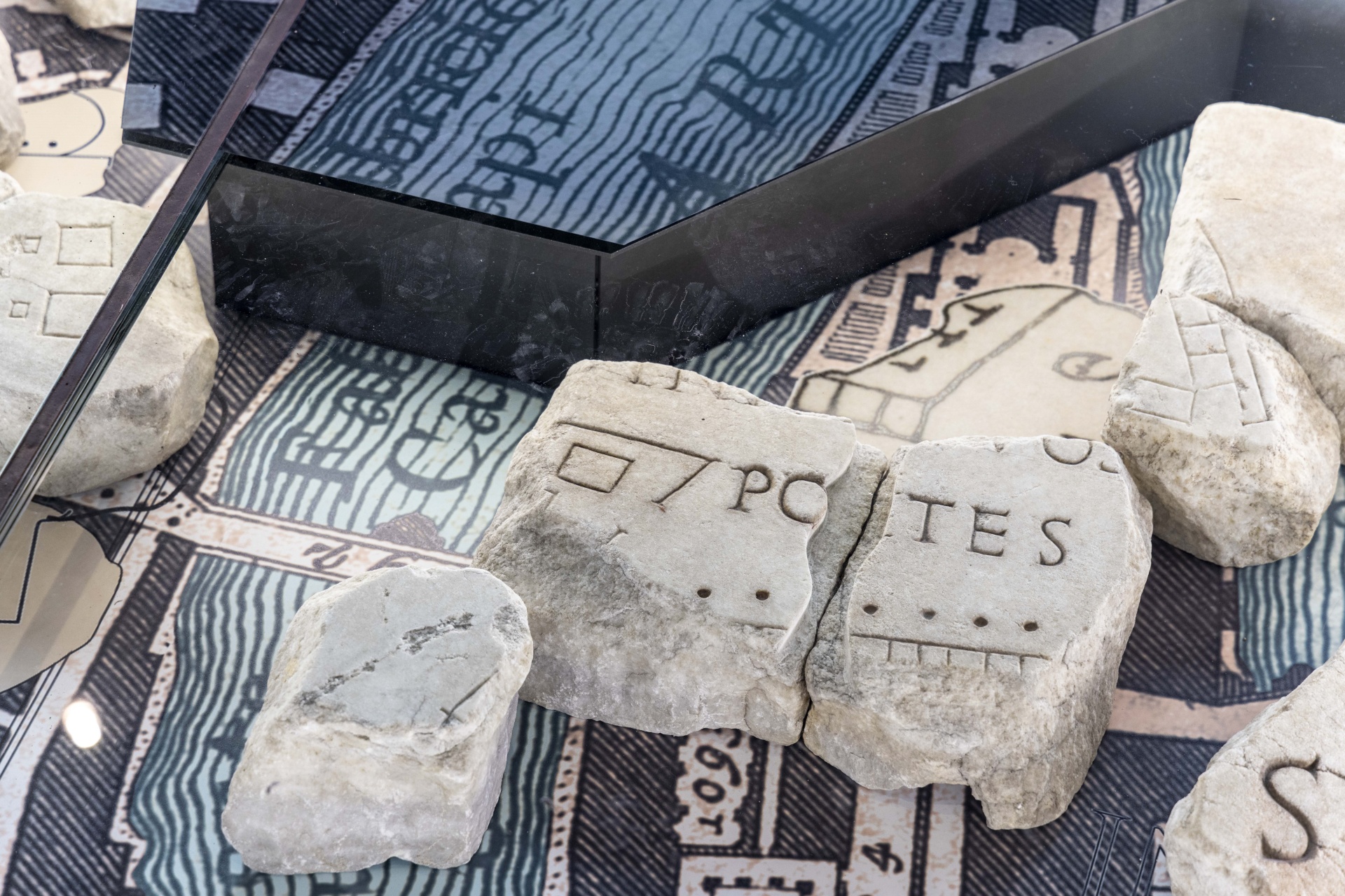
In Rome, the new Forma Urbis Museum was opened , where the preserved fragments of the city’s monumental marble map, known as the Forma Urbis Romae, that is, the “ image of the city of Rome”, are exhibited.
The card was created under the emperor of septicity of the North in 203–211. It was made on 150 marble slabs, and its total size was approximately 18 by 13 meters. The plates were placed on the wall of the temple of the world, built even during Vespasian and restored by Septimia by the North after the 192 fire. Now this wall has become a facade of the basilica of Cosmas and Damian. The plates had a different size and were located on the wall in eleven rows, in the first eight rows from below they were oriented alternately vertically and horizontally, in the three remaining - only horizontally. The plan carved in marble was painted red.
The marble map depicted the city on a scale of 1: 240 and contained plans in fact each structure, including the location of the interior. The first floors of all buildings, including colonnades and internal stairs are presented in detail. Some important monuments are shown on a larger scale. The top of the card corresponds not to the north, as on modern maps, but to the southeast. It is assumed that for topographic shooting, the creators of the card used the peak of Monte-Kavo, the highest point of the Albanian mountains (modern height-950 meters above sea level).
Under the septimia of the North, the Chancellery of the Prefect Rome was located in the temple of the world, where the cadastral plans of the city on the papyrus were stored, and therefore it is assumed that city objects on the marble map were depicted and signed on the basis of these plans.
Fragments of the Coliseum. Photo: Capitoline Superintendence of Cultural Heritage of Rome Capital
The map was gradually destroyed in the Middle Ages, and marble slabs were used as building materials or for the production of lime. In 1562, the young sculptor-Antikvar Giovanni Antonio Dosio excavated fragments of the card on the site near the Basilica of Cosmas and Damian. Excavations were carried out at the initiative of the condotier-gumanist Torkvato Conti (combining the commander’s long career with interest in architecture, alchemy and literature), who acquired the rights to excavation from the canonics of the church. Conti was presented with finds by Cardinal Alessandro Farneze, who entrusted them with his librarian Onofrio Panwinio and Antiquar Fulvio Orsini. Marble fragments seem to have not aroused much interest. Many plates were broken and used as a building material for Farnese gardens. The surviving fragments were in the Palazzo Farneze until 1741, after which they entered the collection of the Capitol Museums and were stored in the Palazzo dei conservatories.
Today, only 1186 fragments of a marble map of different sizes have been preserved: from entire slabs to small fragments. Together, they make up 10-15 % of the entire card. 87 fragments were lost before the transfer of the map of the Capitol Museums, but preserved in the sketches of the Renaissance. At the moment, about two hundred fragments of the card were tied to the terrain. The archaeologists have helped to understand the location of the slabs by the holes that have survived to this day in the wall of the Temple of Cosmas and Damian, into which iron pins were once inserted, fastening marble slabs. Fridges of the fragments continue today, for example, in 2016 a fragment containing part of the Marcell theater was discovered . Thanks to the inscription available on it, he was able to join with parts of the map, known since 1562.
Archaeological Park of Celias. Photo: Capitoline Superintendence of Cultural Heritage of Rome Capital
The Forma URBIS Museum is located inside the new archaeological park of Club - the green zone on the hill overlooking the Colosseum, where many archaeological, architectural and epigraphic finds are now exhibited. They were discovered during excavations at the end of the 19th century, when Rome, which became the capital of united Italy, was experiencing a construction boom. To store a huge number of archaeological materials in 1884, a municipal antiquarium was built on the virgins. He acted as a public museum from 1929 to 1939, but was closed due to the problems caused by the construction of the metro. The new archaeological park represents these objects organized in thematic groups that will allow visitors to study different aspects of Roman society: a reflection of social status, expressed in funeral monuments, the contrast between the modest sacred spaces of the republican Rome and the largest temples of the imperial era, the difference between public and private buildings, the evolution of the architectural taste and methods of processing processing methods marble, as well as methods of re -use and processing of artifacts.
Fragments in the new museum are placed under the floor of the main hall and imposed on the Pianta Grande di Roma Giovanni Nolly Battisty in 1748, which is an equally detailed plan of the city as Forma Urbis Romae .
The park and the museum opened to visit on January 12.