In the water area, Gelendzhik began to jam the GPS signal. There could be withdrawn from Novorossiysk ships of the Black Sea Fleet • The Insider • RIMA — Russian Independent Media Archive
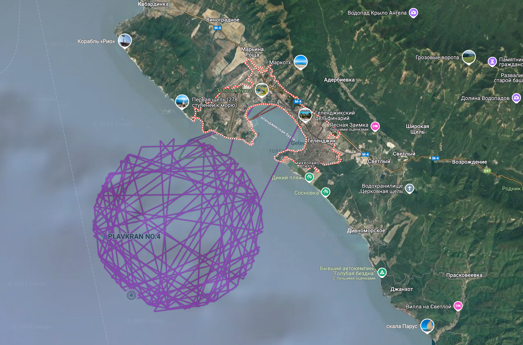
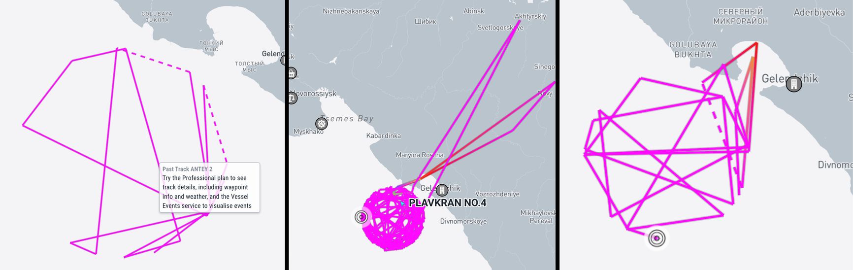
In the water area of Gelendzhik, right at the entrance to the Gelendzhik bay, GPS began to suddenly jerk . This has become noticeable in the strange behavior of ships on the Marinetraffic website, which tracks the sea routes thanks to the AIS system. Judging by the map, several ships began to “drive a round dance” - walking in a circle right at the entrance to the bay. Hi Sutton drew attention to this.
Jamming (GPS Jamming) - is carried out by a wave transmitter who sends his signal on the same radio frequencies - stronger than the one that comes from the satellite, drowning him.
AIS Automatic Identification System is one of the systems in shipping, which serves to identify ships, their dimensions, course, and for use by means of mobile and fixed civilian services. AIS data use ships tracking services, in particular, Marinetraffic. Military vessels most often do not include this transmitter and are not displayed on the relevant services.
Screenshots: The Insider
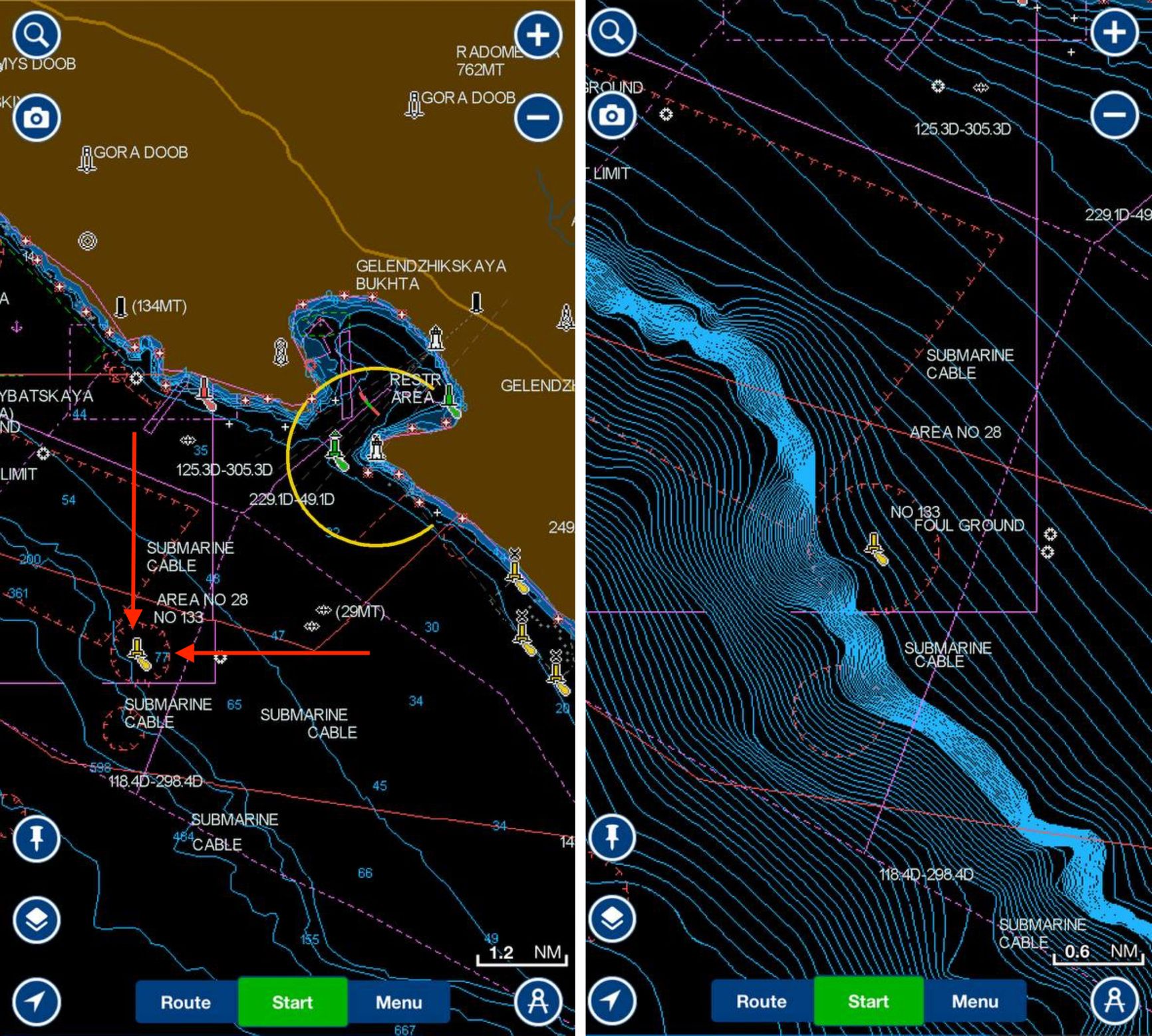
According to the analyst, the reason for the strange behavior of the ships is that in this area of the water area the GPS signal was turned on. Hi Sutton notes that the jamming is concentrated in the Buya number 133. How was the insider convinced, having studied navigation cards, circles are really drawn around this buoy. He notes the place of soil discharge during the deepening of the channels, for example, in the port. He does not carry any other functions, only shows a change in the bottom, but it can be hung on it “muffler”.
Jamming (GPS Jamming) - is carried out by a wave transmitter who sends his signal on the same radio frequencies - stronger than the one that comes from the satellite, drowning him.
AIS Automatic Identification System is one of the systems in shipping, which serves to identify ships, their dimensions, course, and for use by means of mobile and fixed civilian services. AIS data use ships tracking services, in particular, Marinetraffic. Military vessels most often do not include this transmitter and are not displayed on the relevant services.
Screenshots: The Insider
Earlier, Hi Sutton, based on satellite images, noted that Russia led the ships of the Black Sea Fleet from the port of Novorossiysk in an unknown direction. Given the siege of warships (4–6 meters) and the depths in the water area of the Gelendzhik Bay (9–13 meters, 17 meters at the entrance to the bay), it can be placed in anchor from the Novorossiysk court, was convinced by The Insider for navigation cards.
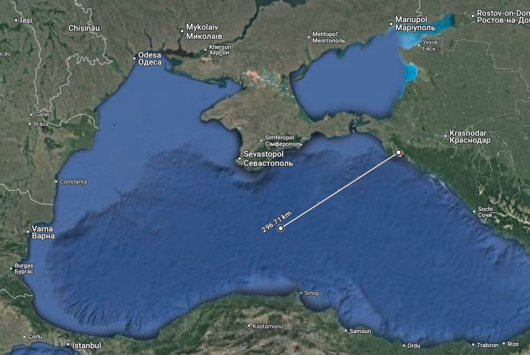
Hi Sutton suggested that the ships were brought out of Novorossiysk, as Russia fears that Kyiv would receive permission to use Storm Shadow missiles. At the same time, from the port of Novorossiysk and from the Gelendzhik Bay, the distance to the combat contact line exceeds the Storm Shadow range (the West will not give permission to use missiles above the shortest allowed trajectory of 300 km).
However, Storm Shadow can be launched from fighters over the Black Sea, so the RF Armed Forces can simply be reinsured. Theoretically, you can fly in the airspace of Ukraine, Romania, Bulgaria, go into neutral space and shoot from the borders south of Crimea from there. In Gelendzhik, it is probably easier to organize protection than in the overloaded port of Novorossiysk.
Jamming (GPS Jamming) - is carried out by a wave transmitter who sends his signal on the same radio frequencies - stronger than the one that comes from the satellite, drowning him.
AIS Automatic Identification System is one of the systems in shipping, which serves to identify ships, their dimensions, course, and for use by means of mobile and fixed civilian services. AIS data use ships tracking services, in particular, Marinetraffic. Military vessels most often do not include this transmitter and are not displayed on the relevant services.
The ships could relocate to a more closed Gelendzhik bay to protect against unmanned surface devices. This could explain the installation of jamming at the entrance.
Earlier, Bellingcat reported that Russia accelerated the construction of asylum for the Black Sea Fleet in Abkhazia. The new Russian naval base, which, according to the head of the region, will become the “permanent place of deployment” of parts of the Black Sea Fleet of Russia, will be located in Ochamchir.
Jamming (GPS Jamming) - is carried out by a wave transmitter who sends his signal on the same radio frequencies - stronger than the one that comes from the satellite, drowning him.
AIS Automatic Identification System is one of the systems in shipping, which serves to identify ships, their dimensions, course, and for use by means of mobile and fixed civilian services. AIS data use ships tracking services, in particular, Marinetraffic. Military vessels most often do not include this transmitter and are not displayed on the relevant services.